What Is a Drone 3D Model?
A drone 3D model is a digital representation of real-world objects or environments created using aerial images captured by drones. This process, known as aerial photogrammetry, involves taking multiple overlapping photos from different angles and using specialized software to generate a three-dimensional model.
Drones are widely used for aerial photogrammetry to capture detailed images of land, buildings, construction sites, and other structures that are difficult to access. These images are then processed through 3D modeling software to create accurate and detailed models that can be used for analysis, planning, and visualization.
Why Drones Are Great for Aerial Photogrammetry
Drones offer an affordable and efficient alternative to traditional methods like using airplanes or helicopters for aerial data collection. They are easy to operate, portable, and can be deployed quickly. Additionally, modern drones come equipped with geotagging technology, which automatically records GPS data along with each image. This helps in creating more precise and reliable 3D models.
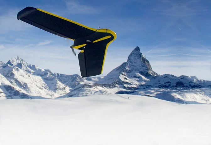 The eBee Classic, a drone made just for surveying and mapping
This geospatial data—such as altitude, longitude, and latitude—is crucial for accurately reconstructing the real-world environment in 3D. With the right tools, these images can be transformed into highly detailed models that allow users to measure distances, calculate volumes, and analyze spatial relationships.
How To Create A Drone 3D Model
Creating a drone 3D model starts with capturing high-quality images from the air. Here's a step-by-step guide to help you get started:
- Choose a high-quality drone. Drones like the SenseFly eBee Classic are specifically designed for aerial photogrammetry and offer excellent image quality and stability.
- Set up ground control points (GCPs). These are reference markers placed on the ground to improve the accuracy of your model. They help align the images correctly during processing.
- Plan and automate your flight path. Use flight planning software to set up a grid pattern that ensures sufficient overlap between images. Make sure your drone’s camera settings are optimized for clarity and detail.
- Survey on a clear day. Avoid cloudy or windy conditions, as they can affect image quality and make it harder to capture consistent data.
- Use 3D modeling software. Tools like Pix4Dmapper or Agisoft Metashape can process your images and generate a detailed 3D model. Some projects may require a GIS specialist to interpret the data effectively.
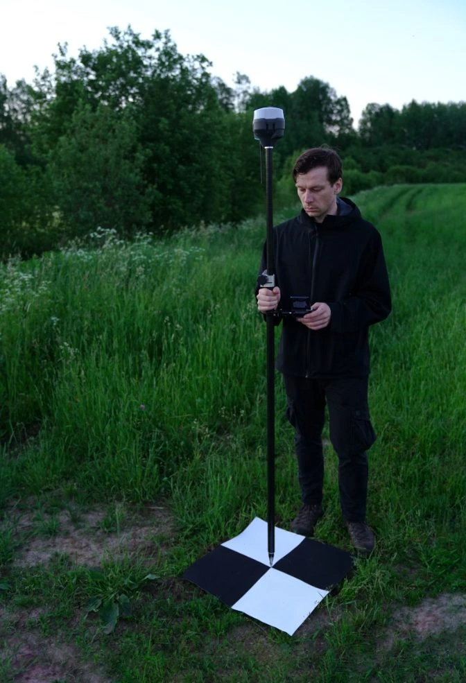 Calibrating GCPs
Getting the Right Data for Your Drone 3D Model
Aerial photogrammetry relies on capturing images from multiple angles. The more photos you take, the better the model will be. For optimal results, ensure that each photo overlaps by at least 60% to 70%. This allows the software to accurately triangulate the position of each point in the scene.
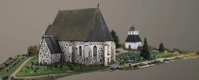 Drone 3D model | Source: Lassi Kaukonen
Key tips for setting up your flight:
- Ensure 60–70% image overlap for accurate reconstruction.
- Fly between 150ft to 200ft for straight-down shots.
- Use different camera angles depending on altitude: 30° for high altitude, 45° for medium, and 70° for low altitude.
- Adjust your flight radius to keep the subject in frame.
Industries That Use Drone 3D Models
Drone 3D models have become essential tools across many industries due to their precision, cost-effectiveness, and ease of use. Here are some key sectors that benefit from this technology:
- Agriculture: Farmers use 3D models to monitor crop health and optimize resource use.
- Architecture & Engineering: Professionals use 3D models for project planning and design reviews.
- Construction: Builders track project progress and conduct inspections remotely.
- Inspection Services: Inspectors identify structural issues without risking safety.
- Land Surveying: Surveyors document changes in landscapes over time.
- Power Generation: Energy companies inspect infrastructure safely and efficiently.
- Public Safety: Emergency responders use 3D models for crime scene analysis and disaster management.
- Real Estate: Agents showcase properties with immersive 3D tours and maps.
The Future of Drone 3D Models
As drone technology continues to evolve, we're seeing new advancements in sensor integration and data processing. Drones like the Elios 3 are now capable of carrying LiDAR sensors, allowing for real-time 3D mapping. This makes them ideal for indoor inspections and complex environments where traditional methods fall short.
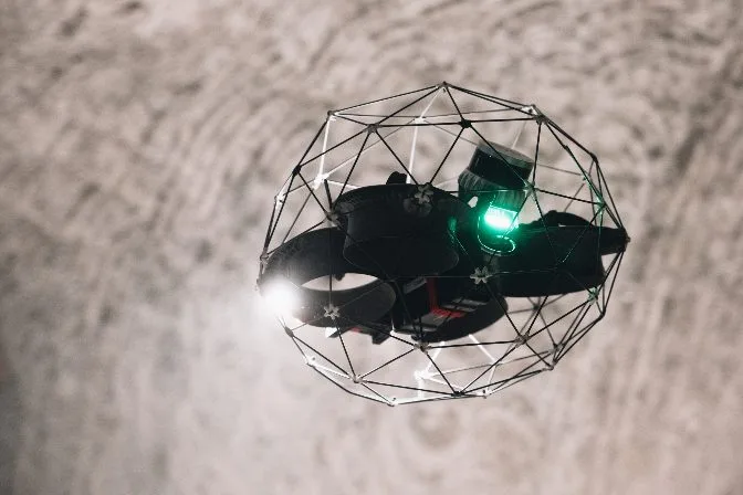
The Elios 3’s ability to create detailed 3D maps in real time is revolutionizing how inspectors gather and analyze data. These models not only help identify potential issues but also serve as valuable records for long-term asset management.
With ongoing innovations, the future of drone 3D modeling looks promising, offering even greater accuracy, efficiency, and accessibility for professionals across various fields.
Titanium Flanged Axle Nut,Titaniium Axle Nut,Titanium Flanged Nut,Titanium Wheel Nut Flanged
Baoji Qiyuexin Metal Material Co., Ltd. , https://www.qyxtitanium.com