What Is a Drone 3D Model?
A drone 3D model is a digital representation of a real-world object or landscape, created using aerial images captured by a drone. This process, known as aerial photogrammetry, involves taking multiple overlapping photos from different angles and using software to convert them into a detailed 3D model.
Drones have revolutionized the way we capture data from the air. They are used to scan landmasses, buildings, construction sites, and other elevated structures. These images are then processed with specialized 3D modeling software to generate accurate and realistic models that can be used for analysis, planning, and visualization.
Why Drones Are Great for Aerial Photogrammetry
Drones offer a cost-effective and user-friendly alternative to traditional methods like manned aircraft or helicopters. Their compact size allows for easy deployment in various environments, making them ideal for both small-scale and large-scale projects. Additionally, modern drones come equipped with geotagging technology, which automatically records GPS data along with each image. This ensures precise spatial information, crucial for creating accurate 3D models.
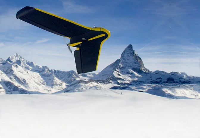 The eBee Classic, a drone made just for surveying and mapping
This geospatial data—such as altitude, longitude, and latitude—helps align the images accurately, ensuring that the final 3D model reflects the real world with high precision. With the right tools, even non-experts can turn these images into detailed 3D models that support measurements of area, volume, and distance.
How To Create A Drone 3D Model
Creating a drone 3D model requires careful planning and the right equipment. Here’s a step-by-step guide to help you get started:
- Get a drone with a high-quality camera. Drones like the SenseFly eBee Classic are specifically designed for aerial photogrammetry and offer excellent image quality.
- Set ground control points (GCPs). These are reference markers placed on the ground to improve the accuracy of your model. They provide known coordinates that help align your images correctly.
- Plan and automate your flight path. Ensure your drone is calibrated properly, with correct gimbal angles, aperture settings, and shutter speed. Use flight planning software to map out an efficient route.
- Survey on a clear day. Avoid cloudy or rainy conditions, as they can affect image quality. Choose a time when lighting is optimal for capturing sharp and clear images.
- Use 3D modeling software. Platforms like Pix4Dmapper or Agisoft Metashape can process your images and generate a detailed 3D model. Some projects may require a GIS specialist for advanced processing.
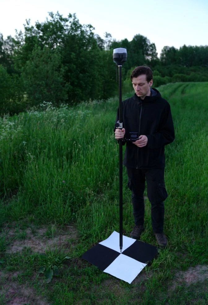 Calibrating GCPs
Getting the Right Data for Your Drone 3D Model
The key to a successful 3D model is capturing enough high-quality images from different angles. Aerial photogrammetry works by identifying common points in multiple images and using triangulation to determine their exact positions in 3D space. The more images you take, the more accurate your model will be.
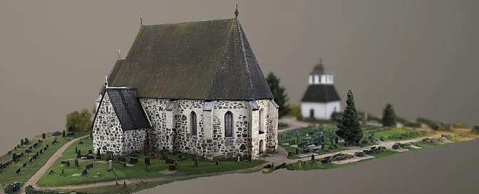 Drone 3D model | Source: Lassi Kaukonen
When setting up your automated flight, keep the following in mind:
- Ensure 60–70% overlap between consecutive images for better triangulation.
- Keep the drone at an altitude of 150–200 feet for straight-down shots.
- Use different camera angles depending on the altitude—70° for lower altitudes, 45° for mid-altitudes, and 30° for higher altitudes.
- Adjust your flight path to keep the subject in frame throughout the mission.
Industries That Use Drone 3D Models
Drone 3D models are now widely used across many industries due to their accuracy and ease of creation. From agriculture to construction, these models help professionals make informed decisions and visualize complex data in a more intuitive way.
Some of the main industries that rely on drone 3D models include:
- Agriculture: Farmers use orthomosaic maps to monitor crop health and optimize resource use.
- Architecture & Engineering: Architects use 3D models to present project designs and secure funding.
- Construction: Project managers track progress and conduct inspections using drone-generated models.
- Inspection Services: Inspectors use 3D models to identify structural issues without risking safety.
- Land Surveying: Surveyors create historical records of terrain changes over time.
- Power Generation: Energy companies inspect infrastructure remotely and efficiently.
- Public Safety: Law enforcement and emergency services use 3D models for crime scene documentation and disaster response.
- Real Estate: Agents use 3D models and orthomosaics to showcase properties online, even when clients can't visit in person.
The Future of Drone 3D Models
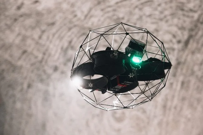
As technology continues to evolve, drones are becoming more advanced, with higher payloads and improved sensor capabilities. For example, the Elios 3 is a drone designed for indoor inspections, featuring a LiDAR sensor that creates real-time 3D maps. This innovation allows inspectors to gather detailed data and identify defects quickly and safely.
These advancements are opening new possibilities for drone-based 3D modeling, making it an essential tool in many fields. As software becomes more accessible and hardware improves, the use of drone 3D models will only continue to grow.
Titanium Tube Heat Exchanger,Heat Exchanger,Tube Heat Exchanger,Titanium Seamless Tube
Baoji Qiyuexin Metal Material Co., Ltd. , https://www.qyxtitanium.com